Snowdon Yr Wyddfa is not only the highest peak in Wales but also the most photographed and one of the best views in Snowdonia, only Tryfan comes close in popularity with landscape photographers. The mountain range covers a large area between the villages of Beddgelert and Llanberis. The shear expanse and height of Yr Wyddfa Snowdon means that it can be viewed in numerous locations and in this article I describe some of the best Snowdon views to photograph this beautiful Welsh mountain
Discover beautiful views of Snowdon Yr Wyddfa

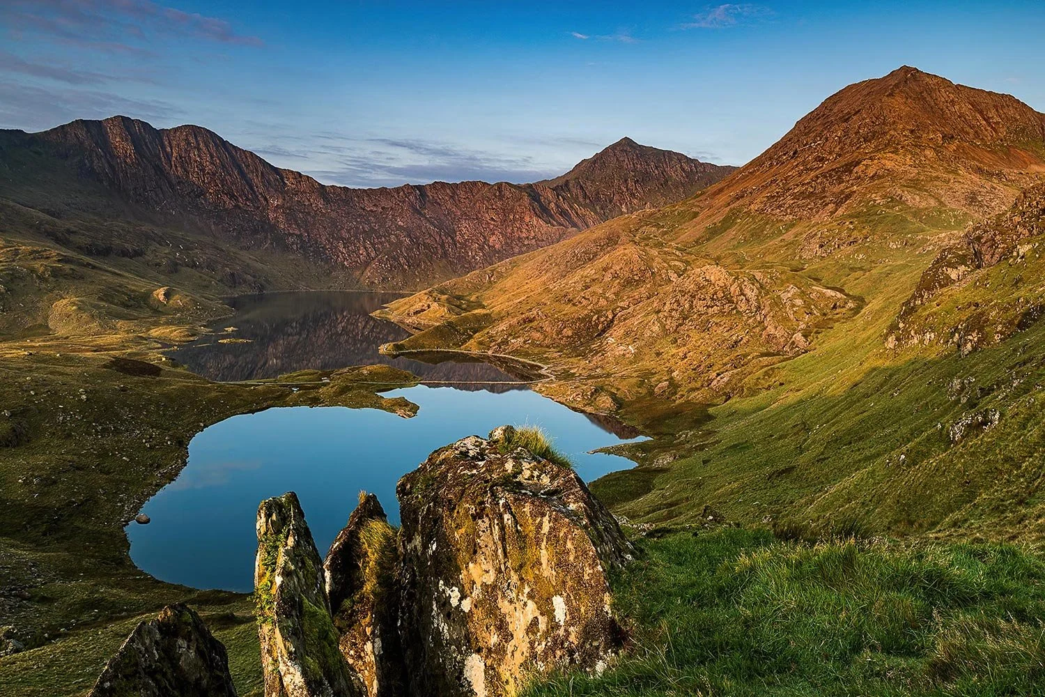
A beautiful sunrise with Yr Wyddfa Snowdon reflected in Llynnau Mymbyr
Wonderful sunrise on the Yr Wyddfa Snowdon Horseshoe and Llyn Llydaw
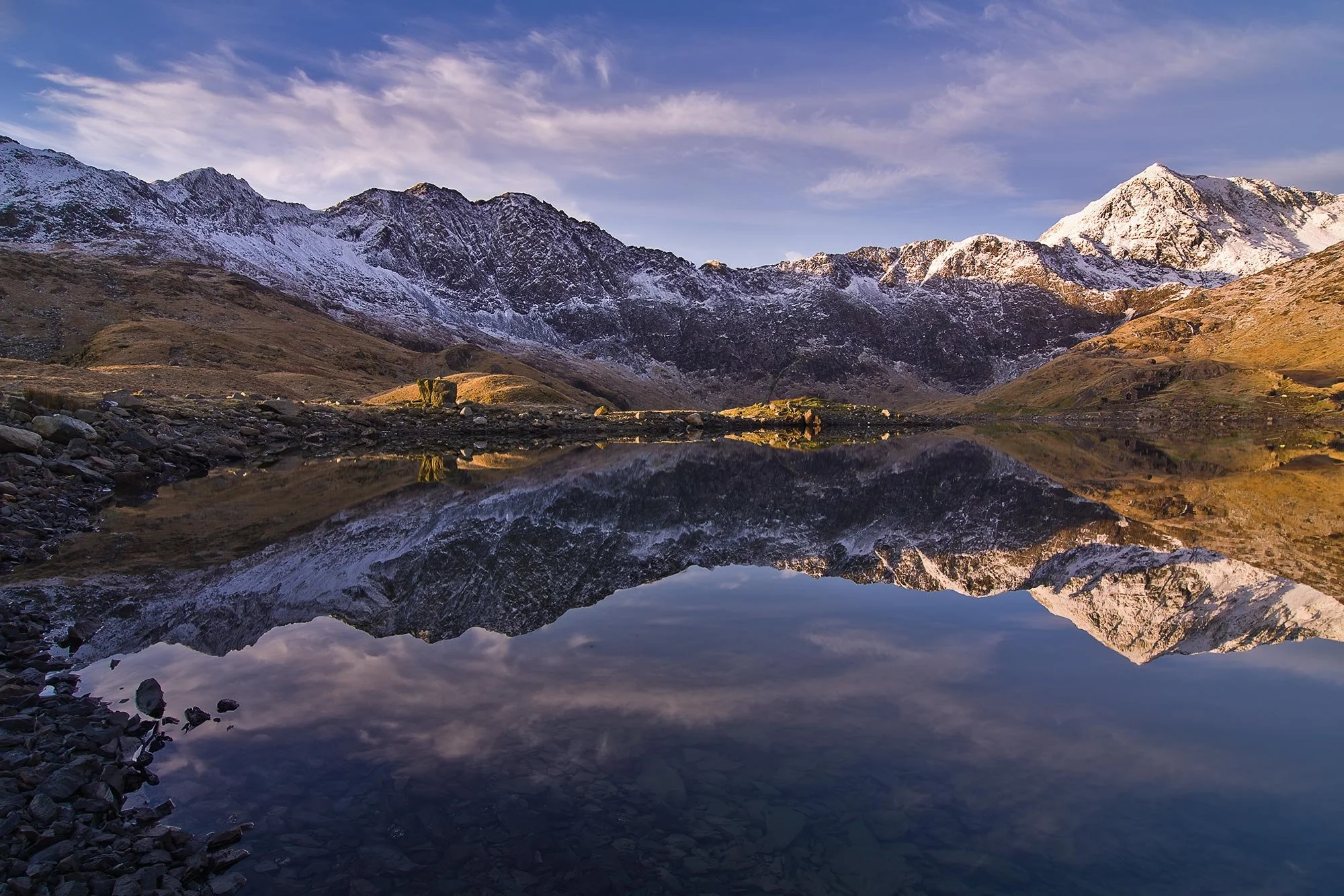
A snow-capped Yr Wyddfa Snowdon Horseshoe reflected in Llyn Llydaw
Snowdon summit
Climbing to the summit of Wales’s highest mountain peak is definitely worth the effort, and literally thousands of visitors will agree! It’s popularity makes timing your visit all the more important if you want some photography time to yourself so mid-week and out of the main holiday periods is definitely advisable. As with most landscape photography sunrise and sunset light often provides the best conditions and they tend to be quiter times with less visitors, although Yr Wyddfa summit at sunrise is increasingly popular with Youtubers and Influencers. My own favourite photography trip up to the summit so far coincided with an incredible winter temperature inversion where it literally felt as though I was on top of the world. As the sun broke above the clouds the light on Snowdon and the surrounding peak of Crib Goch was breathtaking. Some advice I’d give is try to mimimise your camera gear, it’s a good 2.5hrs to the summit and a long way to carry a heavy backpack; a standard zoom lens (24-70 full frame) covers a good range with lots of photo opportunities but f you don't mind some additional weight then add a longer telephoto lens to your kit.
🏔️ Snowdon Summit Routes (Yr Wyddfa)
1. Llanberis Path – Easiest, gradual climb
• Start: Llanberis
• Time: 5–7 hrs round trip
2. Pyg Track – Shorter, steeper
• Start: Pen-y-Pass
• Time: 4–6 hrs
3. Miners’ Track – Scenic, steady start
• Start: Pen-y-Pass
• Time: 5–6 hrs
4. Watkin Path – Toughest route
• Start: Nant Gwynant
• Time: 6–7 hrs
5. Rhyd Ddu Path – Quiet, panoramic
• Start: Rhyd Ddu
• Time: 5–6 hrs
6. Ranger Path – Steady, less busy
• Start: Llyn Cwellyn
• Time: 5–6 hrs
🚡 Train Option
Snowdon Mountain Railway from Llanberis (book ahead)

Stunning temperature inversion from Snowdon summit

Watching the sunrise on Snowdon summit

Stunning summer view from Snowdon summit
Llynnau Mymbyr Capel Curig
One of my favourite viewpoints for photos of Wales’s highest mountain, and certainly one of the most popular with visitors is from the twin lakes of Llynnau Mymbyr on the A4086 just next to Capel Curig. Access is extremely easy, requiring little to no effort but despite this the views of Wales’s highest mountain can be just stunning, especially if you visit on a calm day when the reflections in the lake are jaw dropping. There are different photo opportunities from either of the twin lakes so makes sure to explore both locations spending your time picking out your favourite compositions. Regarding photography equipment here, a good range of lenses is useful; wider focal lengths capturing the rocky foreground on the edge of the lakes whilst longer lenses give you more intimate photo opprtunites of individual peaks of the distant Snowdon Horseshoe.
Located just west of Capel Curig in Snowdonia National Park, Gwynedd, Wales.
🅿️ Parking Locations:
Lay-bys along the A4086 with lake access

Stunning summer reflections of Yr Wyddfa Snowdon

Snow-capped Snowdon reflections
Miners Track, Llyn Llydaw
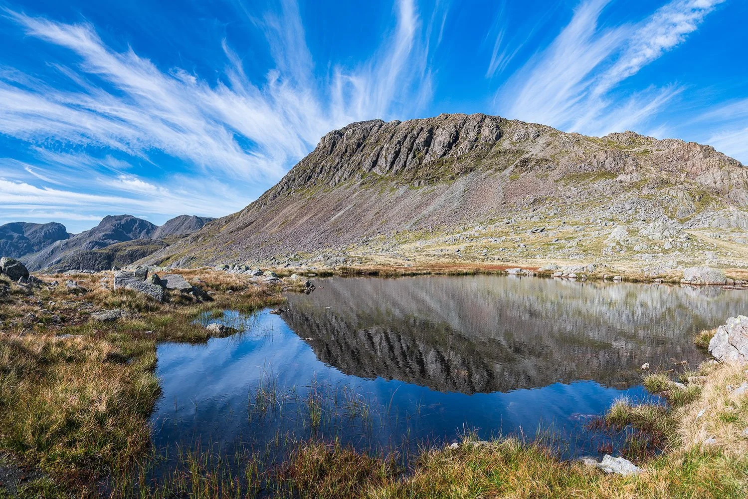
Llyn Llydaw is a beautiful lake under the shadow of Wales's highest peak, Yr Wyddfa. Access is relatively easy from the large, but extremely busy, parking area at Pen Y Pass at the top of the Llanberis Pass. For photos of the lake you follow the popular Miners Track walking just over a 1 mile to the shore of Llyn Llydaw. The Eryri mountains can't fail to impress here with extensive views of Crib Goch, the towering ridges of Y Lliwedd and Crib Y Ddysgl and of course, Yr Wyddfa itself. For photos, you're best visiting early morning as Snowdon and the surrounding mountains are increasingly in dark shadow as the day lengthens; a sunrise photo trip also is your best chance of a “people free” view as the paths to Snowdon are extremely popular with walkers, tourists and photographers at peak times. Photography wise, It's a good idea to have a range of focal lengths again. Wider photos are needed to capture the full scale of Yr Wyddfa (Snowdon) and Crib Goch from the side of Llyn Llydaw whilst telephoto shots give you the chance to photograph the tiny figures making their way across the precarious route on Crib Goch or frame a close-up shot of the old mine buildings just above the Miners Track.
📍 Start Point:
Pen-y-Pass Car Park, A4086 road, Snowdonia
🛣️ By Car:
Navigate to “Pen-y-Pass Car Park” on Google Maps
Located on the A4086 between Llanberis and Capel Curig
⛔ Parking is very limited — often full early in the morning
🚍 Alternative (Recommended):
Park & Ride from Nant Peris (LL55 4UF)
Shuttle buses run every ~15 minutes to Pen-y-Pass

Winter reflections of Yr Wyddfa (Snowdon)
Pyg Track route to Snowdon Summit
The Pyg Track is one of the most popular routes used by walkers heading to Yr Wyddfa summit and it’s a fantastic route from which to take some beautiful photos along the way. On reaching the plateau above the Llanberis Pass, just before the double ladder stiles, take a left over the Horns. This is an infrequently visited view overlooking Wales’s highest mountain and the lake of Llyn Llydaw but some of the best views of the Snowdon Horseshoe. The ladder stiles also provide some interesting foreground for shots along the Pyg Track, with the mountains as the backdrop. The final ascent to reach the Llanberis Path and the train tracks of the Snowdon Mountain Railway reveals a fantastic panorama looking back along your route with the famous Pyg Track zig zags making for some great foreground interest.
📍 Start Point:
Pen-y-Pass Car Park, A4086 road, Snowdonia
🛣️ By Car:
Navigate to “Pen-y-Pass Car Park” on Google Maps
Located on the A4086 between Llanberis and Capel Curig
⛔ Parking is very limited — often full early in the morning
🚍 Alternative (Recommended):
Park & Ride from Nant Peris (LL55 4UF)
Shuttle buses run every ~15 minutes to Pen-y-Pass

Sunrise on the Pyg Track route to Yr Wyddfa

View over Llyn Llydaw from the Pyg Track
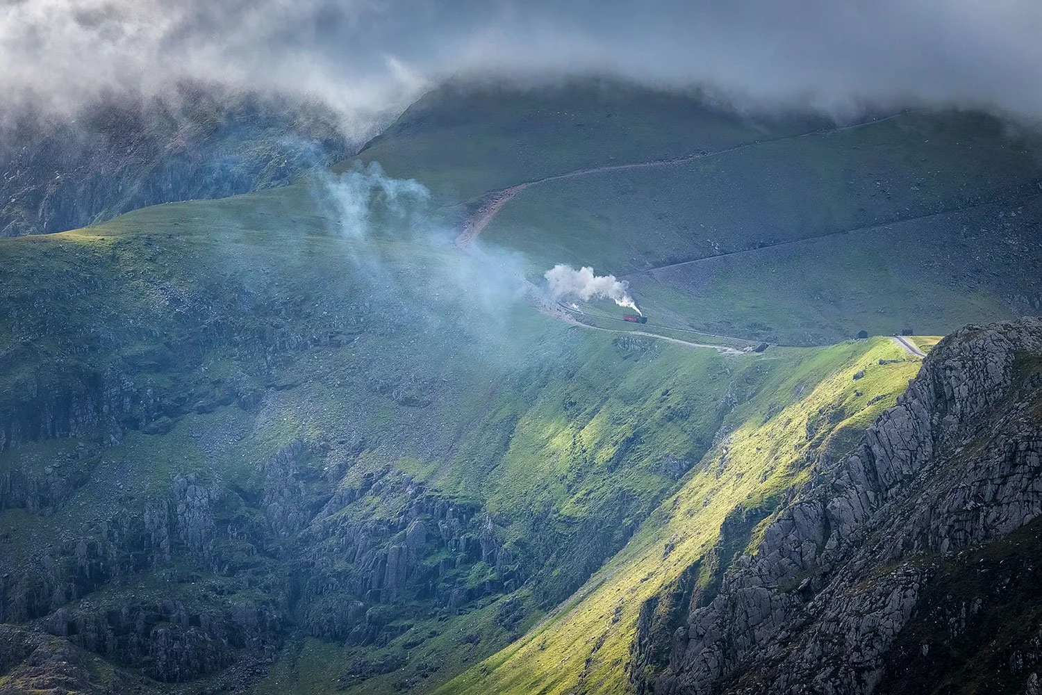
Snowdon Mountain Railway leaving Clogwyn station
Browse All The Photography Galleries
Anglesey Photos
North Wales Photos
Yorkshire Dales & Lake District Photos
UK Coast & Country Photos

Scotland Photos

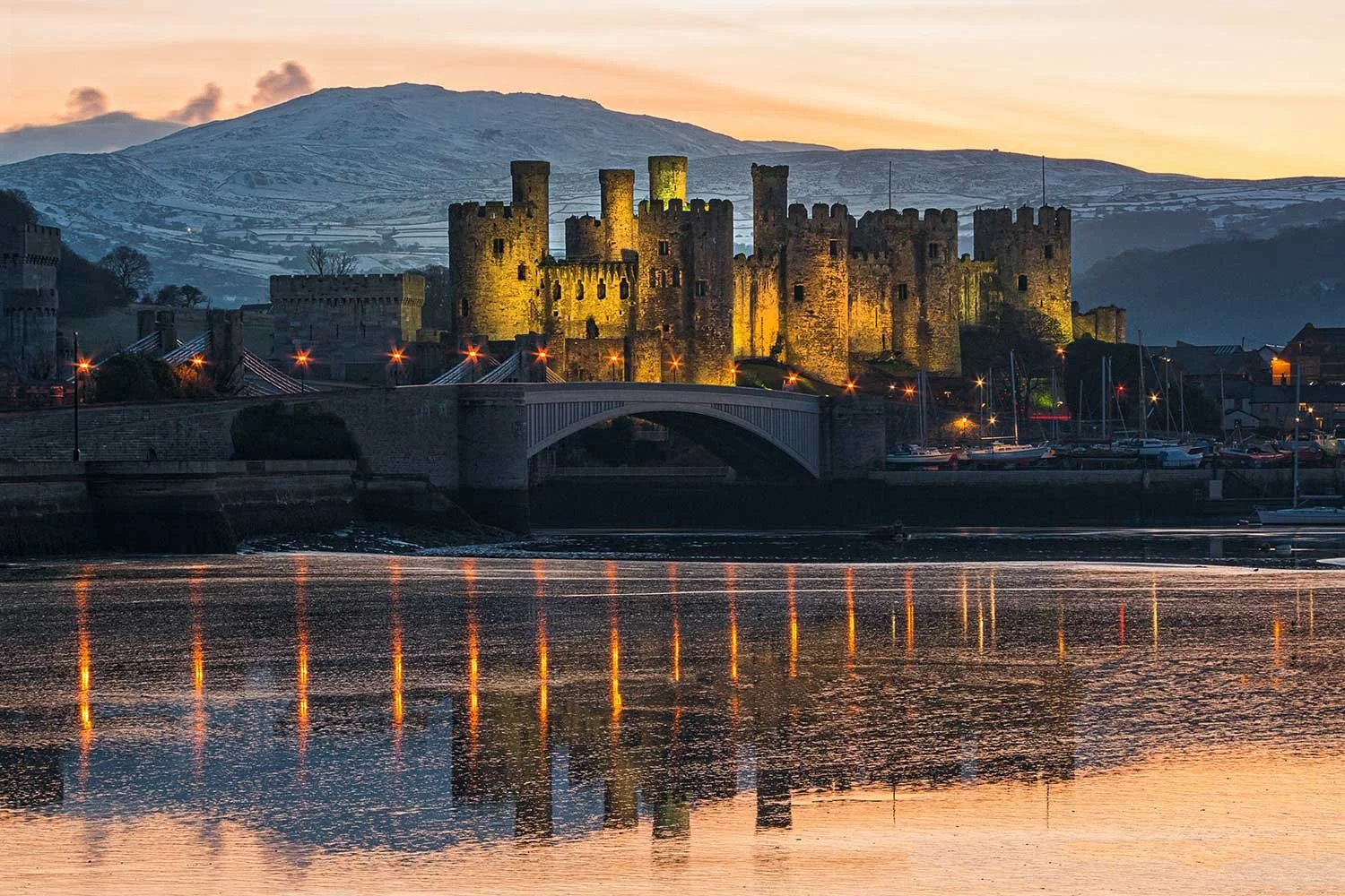
Discover the most beautiful places in North Wales to photograph
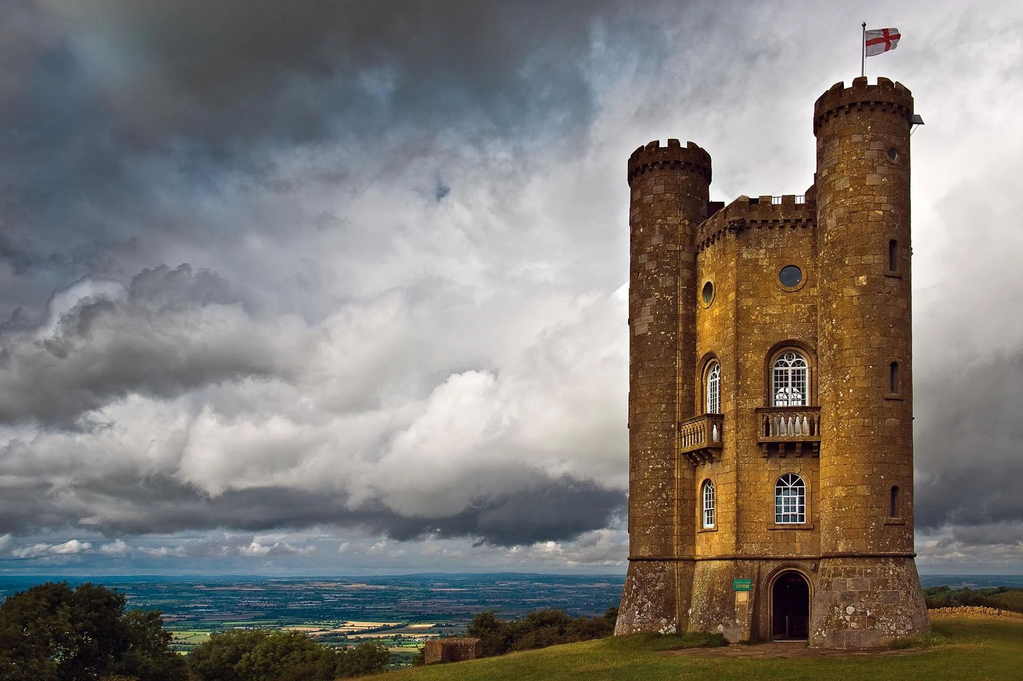
Photographing North Wales is the most comprehensive guidebook for discovering beautiful places in North Wales to photograph. The guidebook will take you on a visual journey to some of the most breathtaking North Wales photography locations, from the rugged peaks of Snowdonia National Park to picturesque coastal villages and historic castles. Whether you’re a professional or hobbyist photographer, or a visitor looking for the best places to visit in North Wales, this guide will help you get the best from your trip.
Featuring over 300 high-quality colour photographs, this comprehensive guidebook details more than 100 of the best locations to explore and photograph across North Wales. Photographing North Wales covers a wide variety of breathtaking destinations, including the iconic Eryri (Snowdonia) National Park, the picturesque Isle of Anglesey, the historic villages and golden beaches along the North Wales Coast, the stunning Llyn Peninsula, and the picturesque countryside of Llangollen and the Dee Valley. Explore the rich culture of North East Wales, including Wrexham and Mold, and capture the scenic beauty of the heather-clad peaks of the Clwydian Hills.
With expert advice and photography tips, including the best times and techniques for photographing these stunning locations, you'll be equipped to capture unforgettable images of North Wales. The guidebook also provides detailed viewpoint information and full route directions to each location, helping you explore and photograph the very best of this diverse and photogenic region
Included with your purchase:
Free UK delivery
Step-by-step guidance to the best North Wales photography locations
Expert tips on how and when to photograph North Wales’ landscapes
Every copy is personally signed by the author.